
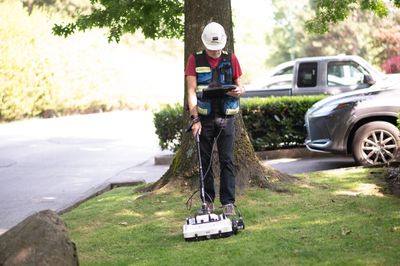
Large Area Subsurface Surveys
Accurate, Cost-Effective Geophysical Surveying for Infrastructure, Environmental, and Resource Projects
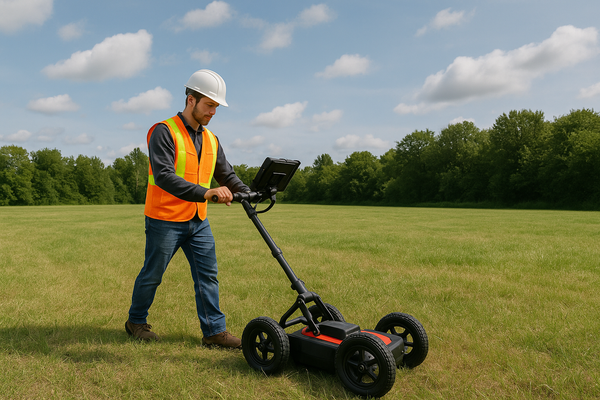
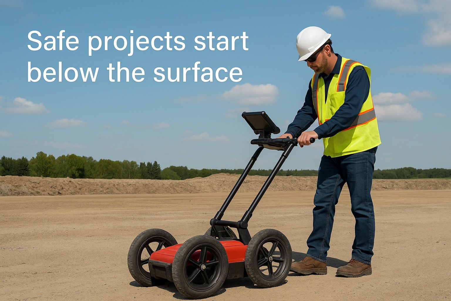
What Are Large Area Subsurface Surveys?
Large area subsurface surveys use advanced geophysical techniques to map underground conditions over extensive terrains. These investigations are essential for infrastructure planning, environmental assessments, and construction risk mitigation.
At Terraprobe, we specialize in scalable, non-invasive surveys tailored to British Columbia’s diverse geological landscapes. Whether you're developing a transportation corridor, planning a new subdivision, or evaluating resource potential, our data-driven approach ensures clarity before you break ground.
When Do You Need a Large Area Survey?
Infrastructure and transportation projects (highways, pipelines, utilities)
-
Pre-construction environmental due diligence
-
Renewable energy site planning (wind farms, solar, geothermal)
-
Archaeological impact assessments
-
Resource exploration and land development
We help clients visualize subsurface features such as bedrock, voids, groundwater, utility networks, and geohazards—supporting smarter planning and risk management.
CALL FOR FASTER SERVICE 604-553-4778
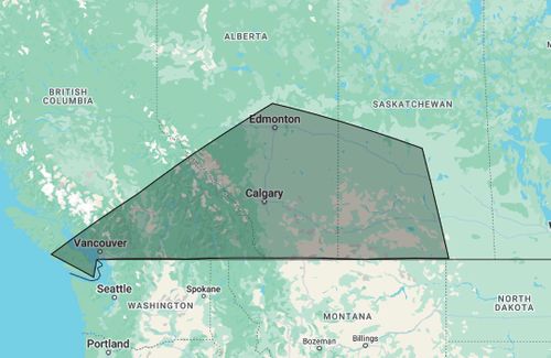
Terraprobe provides Large Area Subsurface Surveys across Western Canada, including projects in Victoria, Nanaimo, Vancouver, Kamloops, Kelowna, Calgary, Edmonton, Saskatoon, and Regina.
Key Considerations for Large Area Subsurface Surveys in BC
Soil Composition & Geology Impact Method Choice
BC’s terrain ranges from sandy coastal soils to mountainous bedrock. The choice of GPR, seismic, electromagnetic, or resistivity methods depends heavily on site-specific soil composition:
-
Clay soils reduce GPR effectiveness
-
Sandy soils improve radar clarity
-
Rocky or densely compacted soils may require seismic profiling or magnetic methods
Terraprobe’s geophysicists assess your site to match the right methods to your subsurface conditions.
Environmental Factors & Moisture Levels
Timing matters. Moisture content affects radar penetration and signal clarity. We schedule surveys during optimal conditions and adapt methodology based on seasonal and environmental factors like:
-
Freeze-thaw cycles
-
Water table levels
-
Rainfall patterns
We bring localized expertise in BC’s Lower Mainland, Fraser Valley, and interior regions to mitigate weather-related risk.
Survey Objectives & Required Depth
What are you looking for—and how deep?
-
Shallow surveys (0–2m): Ideal for locating utilities, shallow foundations, or archaeological features
-
Deep surveys (>2m): Needed for bedrock profiling, groundwater mapping, or geotechnical data
Terraprobe develops a custom survey design based on your goals, adjusting techniques and equipment accordingly.
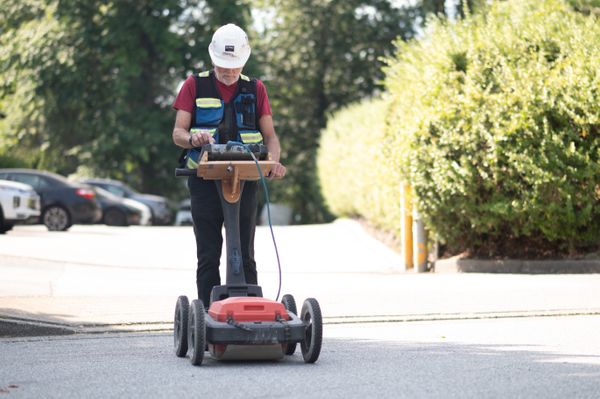
Urban or Infrastructure Interference
Surveying in built environments adds complexity:
-
Interference from rebar, power lines, buried utilities
-
Need for advanced signal processing and high-resolution imaging
-
Risk of false positives from metallic or reinforced objects
We specialize in high-density data acquisition and advanced filtering to deliver reliable results in urban environments like Vancouver, Surrey, and Burnaby.
Choosing the Right Contractor
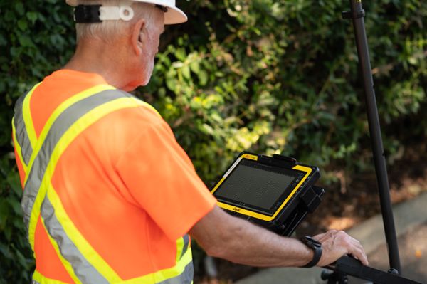
Technical Capability & Equipment Inventory
We use a wide array of tools including:
Ground Penetrating Radar (GPR)
Electromagnetic Conductivity Meters
Magnetometers
Seismic refraction and reflection systems
Multi-channel data loggers for scalable survey coverage
All operated by trained geophysicists with over a decade of field experience across BC.
Quality Assurance & Independent Review
Avoid costly mistakes caused by poor data interpretation. At Terraprobe, we provide:
Third-party quality control review
Transparent methodology documentation
Deliverables suitable for peer review or regulatory submission
Proven Track Record Across British Columbia
We’ve completed major subsurface survey projects for:
Municipalities
Engineering firms
Environmental consultants
Developers
First Nations partnerships
Ask us for relevant case studies from projects like highway widening in the Fraser Valley or land development in the Okanagan.
Planning & Project Integration
Integrated Timeline Support
Terraprobe helps you build realistic timelines by integrating survey windows into your broader project schedule—often prior to test trenching, soil sampling, or EIA submissions.
Flexible Scoping and Contingency Options
Initial surveys may point to new zones of interest. Our contracts are designed with contingency flexibility, so you’re not boxed in by a fixed scope. That saves you time and money later.
Documentation You Can Build On
We provide:
Geo-referenced maps at scalable resolution
Methodology reports and environmental context summaries
Recommendations for additional investigation if needed
Why Choose Terraprobe?
15+ years in BC’s subsurface survey industry
Advanced equipment and licensed technicians
Regulatory-compliant, risk-aware methodology
Transparent data interpretation and reporting
Local knowledge with province-wide reach
Ready to get started?
Experience the best in large area subsurface surveys with Terraprobe. Reach out to our team to discuss your project needs, and let us show you how our precision technology and deep expertise can benefit your project. Contact us directly for more information and cost.
Contact us for a quote on your next project
Download a sample report
⟶ Flexible Pricing Options
⟶ Performance Warranty
⟶ Local Marking & Reports Available
⟶ Large Equipment Inventory