
Utility Locating
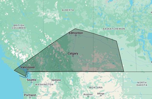
Utility Locating Services in Vancouver and Western Canada
Utility Locating Services in Vancouver, B.C.
Finding underground utilities before you dig isn’t optional—it’s the law, and it’s the safest way to protect your crews, your schedule, and the infrastructure around you.
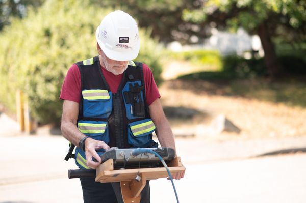
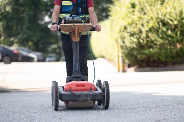
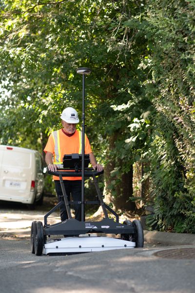
At Terraprobe, we help contractors, municipalities, and industrial operators see the unseen. By combining Ground Penetrating Radar (GPR), electromagnetic (EM) locating, and advanced mapping techniques, our technicians identify buried electrical lines, fiber, water, sewer, and gas services with precision. We bridge the gap between BC 1 Call’s public locates and the private utility networks that often go unmarked—giving you the confidence to dig safely, stay compliant, and keep projects moving.
Why Contractors Call Terraprobe First
In B.C., the density of underground plant is high and variable—ranging from shallow telecom ducts in urban corridors to deep municipal water and sewer mains. Relying solely on records or public locates exposes contractors to risk, because as-built drawings are often outdated and public utility companies are only obligated to mark their own assets. This reality creates blind spots that only private utility locating can resolve.
Q: Isn’t BC 1 Call enough?
No. BC 1 Call will notify utility owners and mark public infrastructure, but it stops at the property line or meter. That leaves private services—campus fiber, secondary electrical feeds, water laterals, irrigation, and site-specific sewer lines—undetected. Terraprobe locates those critical lines so you don’t hit them.
Q: What makes Terraprobe different from others?
We deploy both EM and GPR on every job, ensuring metallic and non-metallic utilities are captured. Our technicians are trained and certified in damage prevention best practices, and we provide not just paint on the ground but project-ready documentation when required—sketches, digital markups, or CAD overlays.
CALL FOR FASTER SERVICE 604-553-4778
Our Technology Toolkit
Different underground utilities interact with detection methods in fundamentally different ways. Metallic conductors carry induced signals, while PVC or clay pipes reflect radar pulses but cannot carry current. Soil conductivity, moisture content, and surface reinforcement further affect resolution and accuracy. A professional locate is not about a single tool but about combining methods to overcome these physical constraints.
Electromagnetic (EM) Locating
- High accuracy when access points allow signal bonding.
- Limitations: cannot trace PVC or clay pipes without tracer wire.
- Ideal for tracing conductive utilities (power, telecom, metallic water/gas).
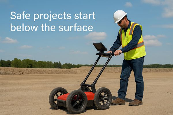
Ground Penetrating Radar (GPR)
- Detects both metallic and non-metallic utilities.
- Provides depth estimates and imaging of unknowns.
- Limitations: performance depends on soil conductivity and site conditions.
Acoustic & Specialty Methods
- Used for plastic water lines and fluid-filled pipes.
- Complements EM and GPR where signals are weak.
Terraprobe integrates these methods, cross-verifying results and reconciling conflicts. Where uncertainty remains, we’ll recommend safe daylighting by hand or vacuum excavation.
Local Rules That Shape Every Locate
Excavation safety in Vancouver is governed by overlapping regulatory requirements: BC 1 Call dictates notification and coordination with utility owners, while WorkSafeBC OHS 20.79 enforces accurate determination of underground services before excavation. These frameworks are supported by tolerance-zone protocols requiring mechanical excavation setbacks until services are exposed and confirmed. Compliance is both a legal and operational necessity.
BC 1 Call (811 Service) – Required before every excavation. Terraprobe coordinates with BC 1 Call locates and fills in the private utility gap that public locators don’t cover.
-
WorkSafeBC Regulation 20.79 – Mandates that all underground utilities be identified and hazards controlled before excavation begins.
-
Tolerance Zones – Mechanical excavation is not permitted within 1 metre of a marked line until it has been exposed and confirmed. Terraprobe’s technicians always mark tolerance zones and advise where hand/vac excavation is required.
Cost and Project Planning
Utility locating costs are driven by measurable variables—site area, density of plant, surface conditions, and available access to utility entry points. Because each of these factors can expand or contract scanning time significantly, the most accurate estimates are rooted in project-specific scoping rather than flat rates.
Q: How much does it cost?
We bill primarily by the hour, with rates depending on project complexity. Factors include:
Site size and number of utilities to trace.
Accessibility of connection points.
Soil and surface conditions (e.g. pavement, rebar, clay).
Travel or after-hours requirements.
Straightforward projects may take only a couple of hours; complex downtown or industrial sites may require a full day or more. Terraprobe provides clear, upfront estimates so you can plan with confidence.
Safety, Certification, and Insurance
The majority of utility strikes are not the result of equipment failure but of interpretation errors, poor communication, or gaps in training. To mitigate this, B.C. has introduced professional certifications such as RULT (Registered Utility Locator Technician) and BCCGA Utility Locator Specialist. Coupled with company-level COR safety certification and comprehensive insurance, these standards create an accountable framework for damage prevention.
Terraprobe technicians are trained to the highest industry standards, including:
BCCGA Utility Locator Specialist training.
RULT (Registered Utility Locator Technician) designation.
Ongoing professional development in EM and GPR techniques.
We maintain COR-level safety programs and full WorkSafeBC coverage. Our insurance includes general liability and errors & omissions protection, giving clients peace of mind that their projects are protected.
Deliverables That Stand Up
Paint on the ground is a transient record—rain, traffic, or site changes can erase it in hours. For engineering, permitting, and long-term asset management, contractors increasingly require formal deliverables: annotated sketches, CAD-ready data, and written reports that integrate with project documentation. These records also serve as proof of due diligence in the event of a strike or audit.
On-site markings
using standardized color codes (red for power, blue for water, green for sewer, etc.).
Field sketches or annotated plans
for contractor records.
CAD-ready reports
for design teams or long-term asset management.
Site walkthroughs
to explain findings and highlight uncertainties before digging.
Our goal is to provide actionable intelligence—not just paint on the ground.
Turnaround and Responsiveness
Selecting a locating partner is ultimately a question of risk allocation. Providers who combine technical breadth, regulatory fluency, and reliable documentation materially reduce the probability of utility strikes and the liability that follows. Those who cannot meet these standards shift the risk back to the contractor.
-
Local expertise: We understand Vancouver’s utility networks, soils, and permitting requirements.
-
Comprehensive methods: EM + GPR + acoustic techniques deployed as needed.
-
Certified staff: Trained and accredited to the highest B.C. standards.
-
Documentation: From markings to CAD overlays, tailored to your project needs.
-
Responsiveness: Same-day and emergency service available.
Ready to Dig Safely?
Before your next excavation, drilling, or trenching project in Vancouver or across B.C., call Terraprobe. We’ll ensure you know exactly what lies below—so you can dig with confidence, protect your crew, and avoid costly strikes.

Project Types We Serve
We work with a wide range of professionals and sectors, including:
-
Engineering firms conducting feasibility and design work
-
Construction companies performing trenching, grading, or pile driving
-
Municipalities and utilities upgrading infrastructure or roadways
-
Telecommunications providers installing fiber networks
-
Developers preparing sites for new builds or renovations
-
Environmental consultants performing site assessments
Every site has different conditions and risks. Our team tailors the detection strategy to your project's scope, soil type, access points, and accuracy requirements.

"Reliable business partners and an experienced team of professionals. They answered our locating needs quickly and they were able to schedule the technicians with a short notice. Will definitely use their services again for future projects."
-Mert Gezgin
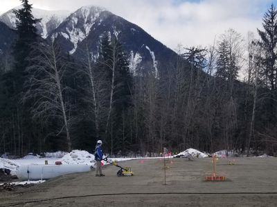
CASE STUDY//
CONSTRUCTION CRANE LOCATION

Client Objective/Goal: Client needed to determine the best spot to place a construction crane.
Project Application: A GPR sub-surface survey of the area was able to show which location was safe to place the crane.
Problem
- Client had a large area of land that they wanted to place a crane one
- Client did not know where underground utilities or concrete footings were located
- Crane could not be placed until these sub-surface anomalies were located to ensure safety
Solution
The Use of the Stream-DP system allowed us to collect data in one direction only as opposed to a grid pattern. This made the data collection much faster and easily done with one technician.
Benefit
Integrated GPS data provides accurate location information for anomalies for the client.
Integrated GPS facilitates accurate coverage of the survey area without using grids.
The Stream-DP provides near 100% coverage which is superior for locating smaller targets.
The client was able to receive valuable data in a short time and low cost relative to other methods and types of GPR systems.
Detection Challenges—and How We Solve Them
Locating buried utilities is never a one-size-fits-all task. Numerous factors affect detection reliability:
Dense or conductive soils may reduce GPR penetration
-
Non-metallic pipes require high-frequency radar and careful interpretation
-
Urban congestion can create signal interference
-
Shallow utilities may be difficult to isolate from surface clutter
-
Obstructed areas may limit equipment maneuverability
Our technicians are trained to assess each site’s unique conditions and adjust the detection approach accordingly. In particularly complex areas, we recommend supplemental scanning or targeted hydro-vac verification.
Integrated Subsurface Solutions
Terraprobe provides more than just utility locating. We offer a suite of subsurface scanning and investigation services, including:
-
Concrete scanning for rebar, conduits, and post-tension cables
-
Void detection to identify sinkholes or subsurface erosion
-
Structural health monitoring for aging infrastructure
-
Geotechnical and environmental scans
-
Archaeological & heritage site investigations
By working with a provider that can do it all, you benefit from faster timelines, cohesive data, and fewer coordination headaches.
Get It Right Before You Dig
With over 20 years of experience and a deep understanding of BC’s terrain, Terraprobe is your trusted partner in subsurface utility detection. Our team ensures you have all the information needed to dig smart, avoid costly surprises, and meet your project goals.
📞 Call us at (604) 555-0312
📍 Serving Vancouver, the Lower Mainland, and beyond
Don't risk what's underground. Get clarity, get Terraprobe.
-

American Society of Civil Engineers CVASCE 38-02
-

CSA Group S250:20 Standard
Subsurface Utility Engineering (SUE) Quality Levels
Terraprobe conducts its utility locating and mapping according to the standards outlined in American Society of Civil Engineers 38-02 and the CSA Group CSA S250:20
QL-A UL Survey using Geophysical methods (GPR & EM) with confirmation using Soft Excavation (Hydro-vac) as necessary. Report in AutoCad showing plan and profile of utilities.
QL-B UL Survey using Geophysical methods (GPR & EM). Report in AutoCad showing utility locations on map.
QL-C UL Survey using Visual Observation of facilities only, eg. Manhole covers, valve chambers etc. Report in AutoCad showing observed utilities on Plan Map.
QL-D BC One Call ticket and GIS information from cities/municipalities only. This includes One Call ticket information as well as other data provided by the utility owners.
Contact us for a quote on your next project
Download a sample report
⟶ Flexible Pricing Options
⟶ Safescan Warranty
⟶ Local Marking & Reports Available
⟶ Large Equipment Inventory